During our last days here in our working area we are shifting it into gear, because it is harvesting time! Finally we will have a look at our data coming back from the sea floor – we all have been waiting for this very moment since weeks now (and some of us since a few years!)
Especially the scientists who will be working with the data in the years to come are excited, so are the PhD students who will use the data for their thesis.
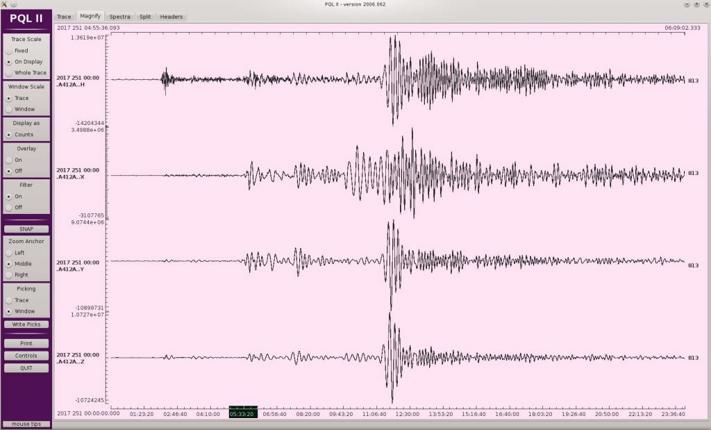
Today at 8 Bft winds, we get an adrenalin-rush every 45 minutes, because this is the frequency with which we are recovering our ocean bottom seismometers. And then it takes a few more minutes before we can finally have a first glance at the data on the computer screens: Earthquake waves generated by the Sept 9, 2017 Mexiko earthquake (magnitude 8.2). The waves travel through the earth, similar to a medical computer tomography. We use these data to reconstruct the inner structure of our planet (see image above).
We deployed our instruments all over the Ligurian Sea and together with our Italian colleagues we could even place some land stations on the island of Corsica, to register our acoustic signals.
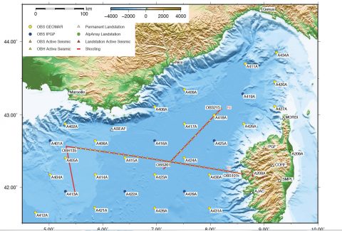
Distribution of ocean bottom seismometers and location of seismic profiles (red lines) in the Ligurian Sea. Map: A. Dannowski, GEOMAR
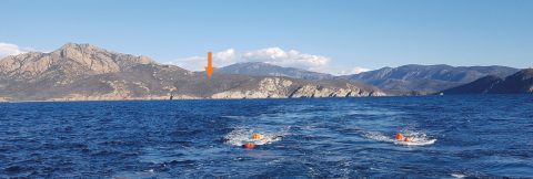
The position of a land seismometer on Corsica is marked by the orange arrow. In the water the orange bulbs mark the position of our airguns. Photo: A. Paul, ISTerre.

Our data loggers pile up in the seismic lab. Photo: M. Neckel, EOMAR/CAU.
We will (hopefully) keep that 45-minute sequence for the coming 36 hours, so that our working deck and labs will again be full of gear, waiting for shipment back home from
Heraklion.
Heidrun Kopp
Chief Scientist MSM-71, at sea
(For a German version of this blog please go to planeterde.de)