Hello world,
greetings from the scientists aboard the research vessel Maria S. Merian. We started two days ago in Southampton with a tight work schedule and many expectations for the cruise MSM63-PERMO. Our aim is to survey the major fluid escape features in the central North Sea.
We did arrive in the southern Viking Graben on Monday evening. The first site with a representative seismic chimney structure was A03 [Karstens & Berndt, 2015]. Jens Karstens carried out a detailed mapping, quantification and interpretation of exploration type reflection seismic data and identified this target during his PhD thesis. This industry seismic data provides 12.5 m horizontal and ~10 m vertical resolution. Therefore, the uppermost sediments are not well resolved.
To assure the existence of a seismic chimney up or close to the seafloor, we carried out a site survey with high-resolution multibeam (Kongsberg EM712) and Parasound data (Atlas Parasound P70). This was crucial to achieve the main goal of our cruise, as we intend to drill into such a system. And the British Geological Survey (BGS) RockDrill 2 (RD2) is capable of drilling up to 60 m into the subbottom.
The multibeam system sends out beams with high frequency (40-100 kHz) and measures their time of return. Thereby it creates a high-resolution image of the seafloor. The system aboard RV Maria S. Merian was just mounted to the hull of the ship during the shipyard stop three weeks ago and we are very lucky that we can use this state of the multibeam system.
The sediment profiler Atlas Parasound P70 uses very high frequencies to provide a high-resolution image of the subbottom up to 200 m. The system provides high-resolution images of the sediments at the A03 site up to 12 m below the seafloor.
Unfortunately, the Parasound data did not show any indication for fluid flow in the upper sedimentary succession. In the early morning on Tuesday 2nd we decided to abandon the site and head towards our alternative target, the Scanner Pockmark. In geology a pockmark describes a round depression in the seafloor, which was created by rapid fluid ascent.
The Scanner Pockmark was described and interpreted by Judd et al. [1994] and is located on the Witch Ground. Their descriptions and interpretations document fluid escape in form of gas flares from the seafloor. In addition, industry seismic data show indications for a chimney structure beneath this pockmark. Therefore we can be sure that must be a fluid conduit underneath the seafloor.

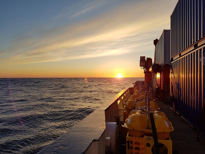
OBEMs and Sunset (Picture: Christoph Böttner)
As we arrived at the target we were well prepared to deploy our ocean bottom seismometers (OBS) and ocean bottom electromagnetic receivers (OBEM). The weather started to be very sunny and with the perfect plan we were finished within record time.
Now we are starting to deploy a controlled source electromagnetic (CSEM) system (DASI &Vulcan). How this works out, we will tell you in the next few days.
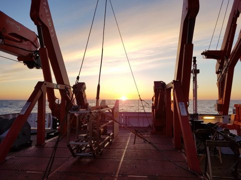
DASI and sunset (Picture: Christoph Böttner).
So long and thanks for all the fish,
Christoph & Michel
References:
Judd, A. G., Long, D., & Sankey, M. (1994). Pockmark formation and activity, UK block 15/25, North Sea. Bulletin of the Geological Society of Denmark, 41(1), 34-49.
Karstens, J., & Berndt, C. (2015). Seismic chimneys in the Southern Viking Graben–Implications for palaeo fluid migration and overpressure evolution. Earth and Planetary Science Letters, 412, 88-100.