(English below) In meinem ersten Beitrag zur gerade stattfindenen Wirbeljagd im tropischen Atlantik habe ich von mehreren autonomen Geräten gesprochen, die schon vor der Schiffskampagne vor den Kapverdischen Inseln im Einsatz waren, um die anrückenden Wirbel einer Voruntersuchung zu unterziehen.
Zwei dieser Geräte möchte ich heute genauer vorstellen. Sie zeigen noch einmal deutlich, wie groß das wissenschaftliche Netzwerk ist, dass sich an der Untersuchung der ozeanischen Wirbel beteiligt.
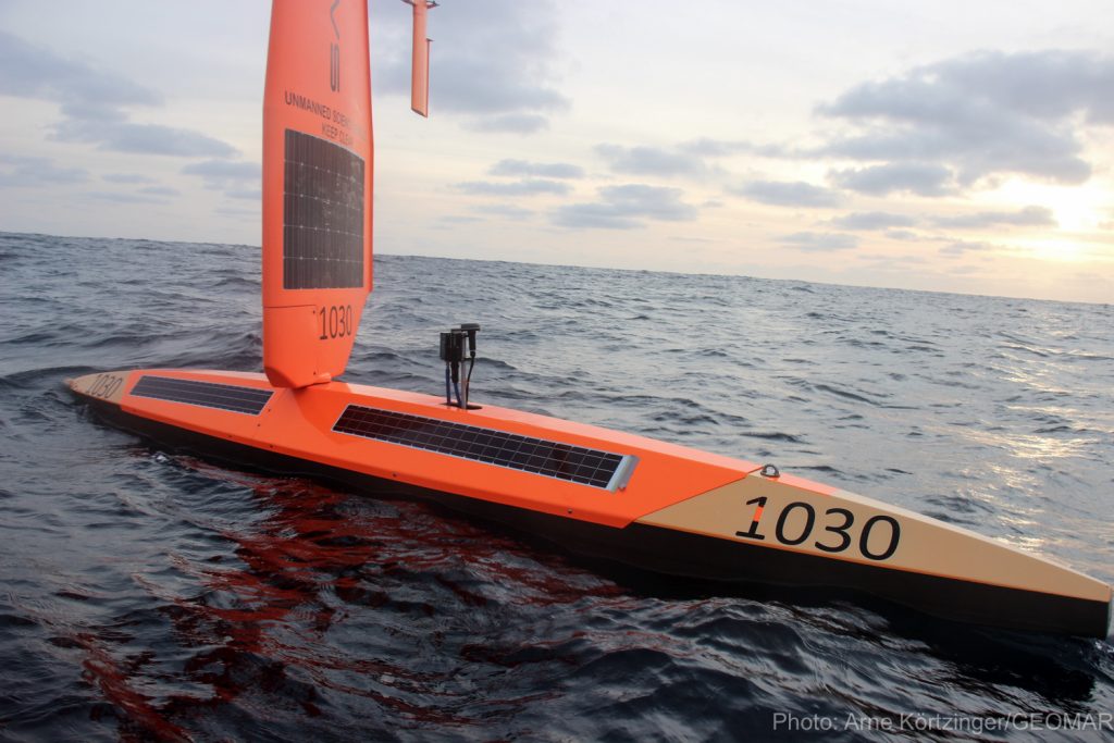
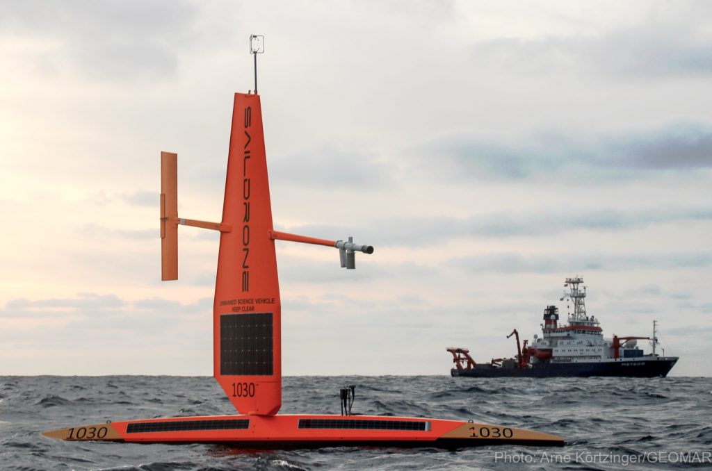
Es handelt sich um zwei autonome Oberflächenfahrzeuge, sogenannte Saildrones. Sie sind mit meteorologischen und ozeanographischen Sensoren ausgestattet und werden – wie der Name schon sagt – vom Wind angetrieben. Solarpanele liefern zusätzliche Energie für die Sensoren. Mitte Oktober haben Kollegen der spanischen Meeresforschungsplattform PLOCAN und des Geräte-Herstellers die zwei Saildrones im Hafen von Taliarte (Gran Canaria) auf eine mehrere tausend Seemeilen lange Reise geschickt, die erst im Frühjahr 2020 in Trieste (Italien) enden soll. Weil diese Reise den Atlantik und das Mittelmeer verbindet, trägt die Mission den Namen „Vom Atlantik zum Mittelmeer“, kurz ATL2MED. Das Netzwerk der Forschungsinfrastrukturen des Europäischen Integrierten Kohlenstoffbeobachtungssystems (ICOS-RI) koordiniert gemeinsam mit dem GEOMAR die Mission. Dahinter verbergen sich 12 Einrichtungen aus sieben Ländern, unter anderem auch das GEOMAR und das HZG.
Unser aller Ziel bei der ATL2MED-Mission ist es unter anderem, die relativ neue Saildrone-Technologie auf ihre Tauglichkeit für die Meeresbeobachtung zu testen. Dabei werden hochgenaue Messsystem auf den Saildrones mit denen der ICOS Meeresobservatorien verglichen. Die Saildrones passieren auf ihrem Weg mehrere dieser Messstationen, darunter auch das vom GEOMAR betriebene Cabo Verde Ocean Observatory (CVOO). Ziel der Messungen mit den Saildrones ist es, die Daten der ICOS Stationen direkt mit den Saildrones zu verknüpfen und so die Daten zu referenzieren.
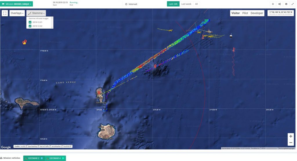
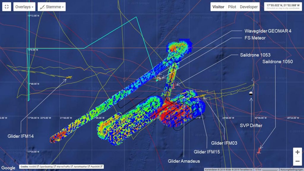
Doch die erste Teilmission der Saildrones ist die #MOSESeddyhunt. Statt sich also gleich von den Kanaren Richtung Mittelmeer aufzumachen, sind die zwei Messroboter erst einmal nach Süden zu den kapverdischen Insel gesegelt. Hier teilen sie sich das Messrevier derzeit mit sechs ozeanographischen Gleitern, zwei Wavegliders und biogeochemischen Argo floats. Die Positionen all dieser Geräte sowie einige Daten findet Ihr hier: navigator.geomar.de. Und mittlwerweile haben wir die Saildrones auch schon vom Forschungsschiff METEOR aus ausgemacht. Wir sind gespannt auf die Daten.
Mehr zu Mission ATL2MED findet ihr auch hier.
Viele Grüße aus dem tropischen Ostatlantik


Sailing measuring robots sighted
In my first post about the #MOSESeddyhunt in the tropical Atlantic, I wrote of several autonomous sensor platforms that have already monitoring eddies off the Cape Verde Islands before we left Mindelo with the RV METEOR.
Now, I would like to present two of these devices in more detail. They once again show how large the scientific network is that participates in the investigation of oceanic eddies.
These are two autonomous surface vehicles, so-called Saildrones. They are equipped with meteorological and oceanographic sensors and – as the name suggests – are driven by the wind. Solar panels provide additional energy for the sensors. In mid-October, colleagues from the Spanish marine research platform PLOCAN and the Saildrone manufacturer sent the two saildrones in the port of Taliarte (Gran Canaria) on a several thousands nautical miles lon voyage, which is scheduled to end in Trieste (Italy) in spring 2020. Because this voyage connects the Atlantic and the Mediterranean, the mission is called “From the Atlantic to the Mediterranean”, or ATL2MED for short. The network of research infrastructures of the Integrated Carbon Observation System (ICOS-RI) and GEOMAR are coordinating the mission. ICOS-IR is made up of 12 facilities from seven countries, including GEOMAR and HZG.
One of the goals of the ATL2MED mission is to test the relatively new Saildrone technology for its suitability for ocean observation. The measurements of the Saildrones will be compared with those of marine observatories. Therefore, the Saildrones will pass several time-series stations on their way, among them the Cape Verde Ocean Observatory, operated by us. The aim is to use the saildrones to connect the observatories with each other and to improve the intercomparability of data between these observatories.
But the first part mission of the Saildrones is the #MOSESeddyhunt. So instead of heading straight from the Canary Islands towards the Mediterranean, the two devices sailed south to the Cape Verde island. Here, they currently share the study area with six oceanographic gliders and two wavegliders and biogeochemical Argo floats. And in the meantime we have also spotted the Saildrones from the research vessel METEOR.
The positions of all these devices can be found in the GEOMAR Navigator.
More about Mission ATL2MED can be found here.
Greetings from the tropical eastern Atlantic
