**** english version below ****
… eine Seefahrt, die ist schön,… so beginnt ein altes Volkslied und in der Tat: Zur See fahren hat schon seinen ganz besonderen Reiz. Mich als Wissenschaftler fasziniert der offene Ozean immer wieder aufs Neue. Ich halte mich jetzt mal mit Beschreibungen hierzu zurück, da man den Ozean einfach auf sich wirken lassen muss. Und am besten geht das auf einem der Forschungsschiffe der Bundesrepublik Deutschland. Wir sind zurzeit auf der MARIA S. MERIAN ca. 60 Seemeilen nordöstlich der Kapverden, Westafrika. 3600m Wasser trennen uns vom Meeresboden. Und genau dieses Wasser interessiert uns. Seit gestern Mittag sind wir fleißig dabei, es mit unseren Geräten von Bord aus zu vermessen und zu beproben.
-
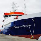
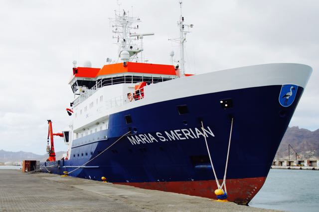
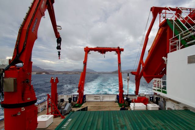
- MARIA S. MERIAN in Mindelo, Kapverden
-
- MARIA S. MERIAN verlässt den Hafen von Mindelo - auf zur CVOO - leaving Mindelo, on the way to CVOO
-
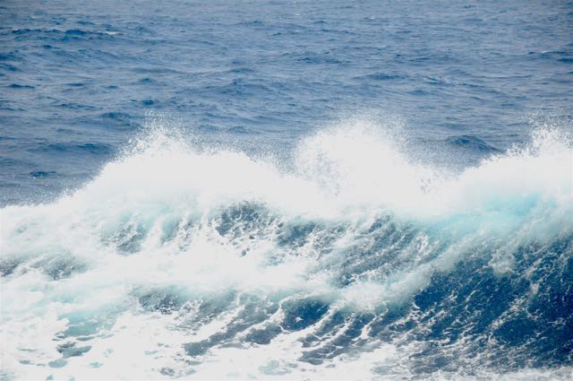
- Blauwasser - the blue ocean
-
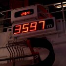
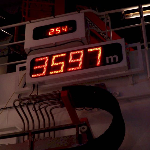
- ganz schön tief - deep ocean
-
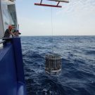
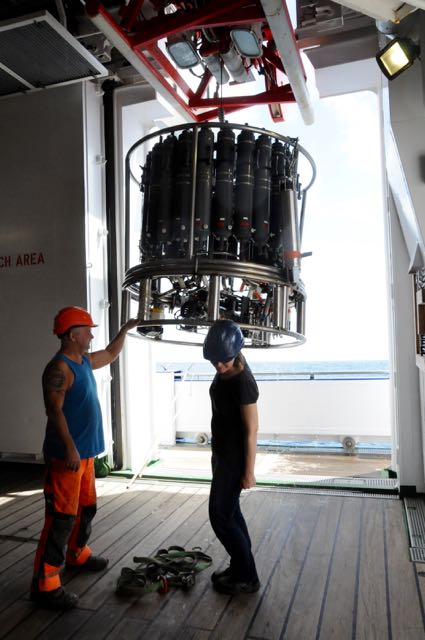
- Die erste CTD taucht ab - first CDT dive
-
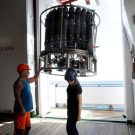
- Die erste CTD kommt zurück an Bord - first CDT back on board
-

- Wann ist die CTD unten? When does the CTD reach the sea floor?

-
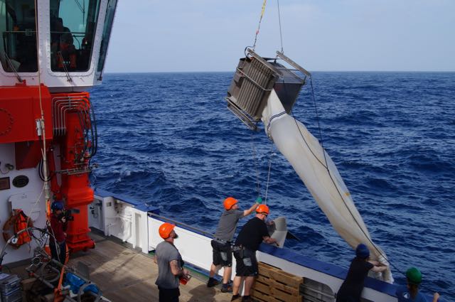
- Das erste Multinetz zurück an der Oberfläche -The first multinet comes back onboard
-
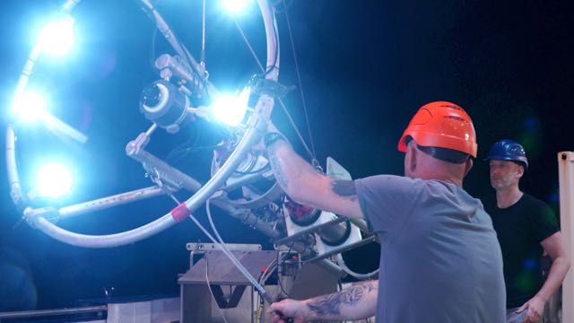
- Das PELAGIOS System zurück an Deck nach dem ersten Tauchgang - PELAGIOS returns after its first dive
-
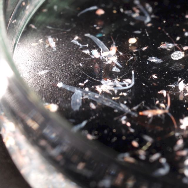
- Der nächtliche Multinetzfang - the night time multinet catch

-

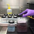
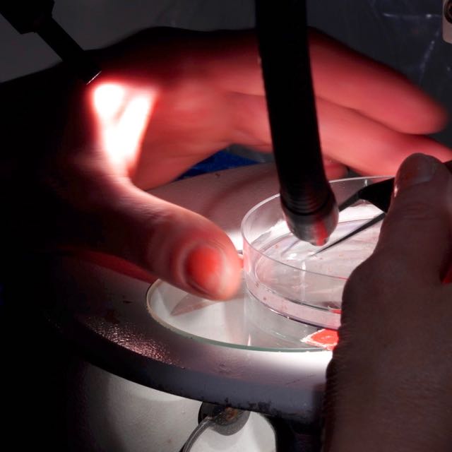
- Plankton sortieren - sorting plankton
-
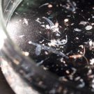
- Multinetzprobe aus 500m Tiefe - sample from 500m
Warum fahren wir gerade hierher, um unsere Messungen durchzuführen? Weil wir seit mittlerweile mehr als 10 Jahren hier zusammen mit Kollegen von den Kapverden regelmäßig Proben nehmen, um die physikalischen, biogeochemischen und biologischen Prozesse im tropischen Nordostatlantik besser zu verstehen und um mögliche Veränderungen in dieser Region zu dokumentieren. Die MARIA S. MERIAN Expedition MSM61 trägt dazu bei, den Zeitseriendatensatz vom Cape Verde Ocean Observatory (CVOO) zu erweitern.
Wir – das sind 19 Wissenschaftler und Techniker aus Deutschland, Spanien, Portugal, Kapverden und den USA, eine Schülerin aus Schleswig Holstein und eine Mitarbeiterin von der OECD (Organisation für Wirtschaftliche Entwicklung und Zusammenarbeit) und 24 Besatzungsmitglieder – werden uns heute im Laufe des Tages weiter gen Osten aufmachen, um einen Unterwasserberg in der Region genauer zu vermessen und zu beproben. Wir wollen seine Auswirkungen auf das regionale Okösystem besser verstehen.
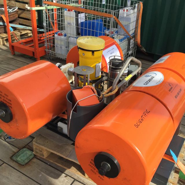
Für die Bewohner der Kapverden sind solche „versteckten“ Berge unter Wasser wichtig, da sie dafür bekannt sind, viel Fisch und andere Meeresbewohner anzulocken. Wir wollen untersuchen, was die physikalischen und biogeochemischen Antriebmechanismen sind und wie sie funktionieren. Nun sind wir nicht die Ersten, die diese Prozesse untersuchen. Aber wir sind die Ersten, die eine Vielzahl von modernen Beobachtungsmethoden gleichzeitig mitbringen, um die Prozesse zeitlich und räumlich hochaufgelöst zu vermessen. Bisher beruhten Kampagnen oftmals einzig auf schiffsgestützten Messungen, in einem sehr engen Zeitraum. Wir wollen diese auch durchführen, jedoch zeitlich noch in die Länge strecken, indem wir auf autonome Messplattformen zurückgreifen, die wir beim Unterwasserberg aussetzen werden. Diese sollen für uns über einen Zeitraum von 6 Monaten jede Menge Daten erheben. So werden wir Geräte auf dem Gipfel des Berges verankern, die z.B. Sauerstoff und Strömungen messen, oder auch autonome Wellengleiter, die auf der Meeresoberfläche fahren und dabei den CO2 Gehalt des Meerwassers und die Biomasse bestimmen. Der Ansatz ist ambitioniert, wird uns im Erfolgsfall aber viel, viel detailliertere Einblicke in das Okösystem vor Ort ermöglichen.
-
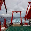
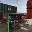
- Auf dem Weg zum Senghor Seamount - on our way to Senghor seamount
-
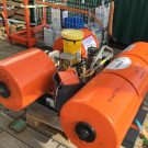
- Lander mit ADCP, lavae traps, timelapse-camera and sensors
-
- GEOMAR waveglider ready for action

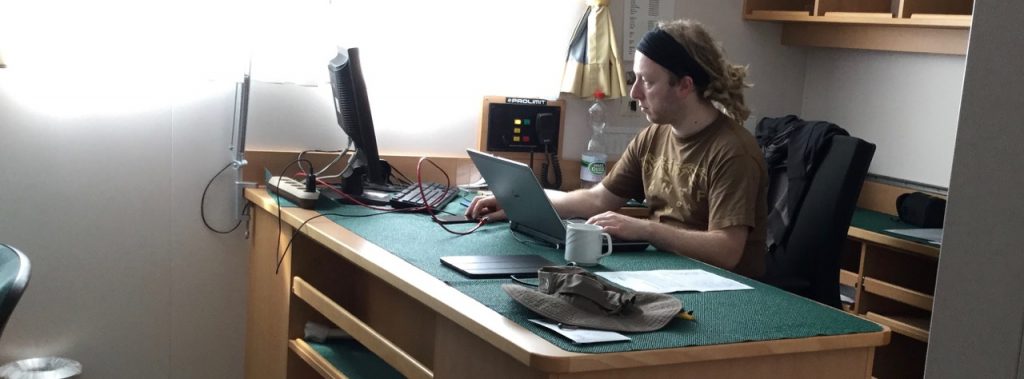
Eine Seefahrt… ist aber nicht nur lustig, sondern bedarf auch einiger Vorarbeit und Organisation. Jede wissenschaftliche Expedition hat einen wissenschaftlichen Fahrtleiter, der die Arbeiten vor, während und nach einer Reise koordiniert. Dies ist meine erste Reise auf See, bei welcher ich in diese Rolle schlüpfen darf. Ganz spannend und aufregend auf der einen Seite, da man als Fahrtleiter doch sehr gut gestalten kann und auch eigene Ideen in die Tat umsetzen kann. Auf der anderen Seite aber auch anstrengend, da man die Verantwortung für das wissenschaftliche Programm hat und sicherstellen muss, dass die äußerst wertvolle Schiffszeit bestmöglich genutzt wird. Das bedeutet planen, planen und planen… am besten rechtzeitig damit anfangen, zwischendurch mal wieder umplanen, da ein Gerät nicht so will, wie man selbst, dann alles mit den verschieden wissenschaftlichen Gruppen an Bord abstimmen, Rücksprache mit der Schiffsleitung halten, Berichte schreiben, neuen Arbeitsplan erstellen, und und und… hört sich zunächst recht anstrengend an. Aber wenn man dann sieht, dass die ersten Daten und Proben an Bord geholt wurden, schaltet man sofort vom organisatorischen in den wissenschaftlichen Modus um und freut sich auf eine spannende Auswertung der Datensätze. Einen ersten Abgleich der Daten werden wir bereits an Bord machen, wenn wir am kommenden Freitag unsere letzte Station beim Unterwasserberg gemacht haben und uns auf unsere dreitägige Heimreise mit der MERIAN nach Las Palmas begeben werden.
Björn Fiedler
**** English Version *****
Eine Seefahrt, die ist lustig, …
… eine Seefahrt, die ist schön,… these are the opening phrases of a German folk song and indeed: sea voyages have their own special appeal. For me as a scientist, the ocean fascinates me again and again. But before I get too carried away I stop here, because you will have to let the ocean sink in for yourself. One of he best ways of doing that is to go on board of one of the German Research vessels. At the moment I am on board of RV MARIA S. MERIAN, some 60 nautical miles Northeast of the Cape Verde archipelago, Westafrica. 3600 metres of water are seperating me from the ocean floor. And in exactly that „pile“ of water is where I am highly interested. Since yesterday noon we are busy measuring and sampling the water column from the deep ocean to the surface.
But why are we out here doing all kinds of different measurents? We have been collaborating with colleagues from Cape Verde for 10 years now. The collaboration allowed us to take samples at this place in the ocean on a regular basis. We want to understand the physical, biogeochemical and biological processes of the tropical Northeast Atlantic. And we want to document any changes happening in this region. The cruise MSM61 will add to the growing data set of the Cape Verde Ocean Observatory time-series (CVOO).
Us, meaning 19 scientists and technicians from Germany, Portugal, Spain, Cape Verde, the USA, one pupil from Schleswig-Holstein, one emloyee from the OECD (Organisation for Economic Co-operation and Development) and 24 crew members – today we will be on our way further to the East to measure and map the conditions at the Senghor seamount. We want to understand what role a tropical seamount has within its regional ecosystem.
For the people of Cape Verde the „hidden“ mountains underneath the surface are very important for fisheries as they are known for being hotspots of life in the ocean and therefore very attractive for fish. We want to understand the driver of the physical and biogeochemical processes in that system and how they work. We are of course, not the first to ask ourselves these questions. But, we will be the first to come here and use a wide range of state-of-the-art technology simultaneously in order to get data of high resolution in time and space. Until now measuring campaigns were mostly ship-based and therefore had great time constraints. You could always only get a snapshot. By using autonomous measuring plattforms, we can greatly improve our resolution in time. We will leave our autonomous vehicles at the seamount for a period of up to 6 months. We will install a lander system on top of the seamount with measuring devices for e.g. oxygen content and biomass. Additionally, two autonomous wave gliders will patrol the surface waters. They are equipped with e.g. CO2 sensor, biomass sensor and a device to measure the currents in the water column down to the summit of the seamount. I am aware that this is a rather ambitious project, but incase of a successful installation we will be get A LOT of data. With that data we will get an enormously detailed insight into the seamount’s ecosystem.
Eine Seefahrt… is not just fun, but needs accurate preparation and organisation. Every scientific expedition is lead by the chief scientist, who is in charge of the preparation before the cruise, who coordiates all scientific work during the cruise and who coordinates all the work that needs to be done after the cruise. This is the first time that I am holding the position as the cruise leader. I find that being the chief scientist has two sides. On the one hand, it is great and very exciting as this time I am in charge of planning and shaping an expedition to suit my ideas. On the other hand, it can be very tiring to be responsible for the scientific program. I have to make sure that the precious ship time is used as efficient as possible. I am always busy with planing and planing and planing and then replaning, because nothing usually happens according to plan. I have to write reports, coordinate the schedule to the captain. Puh….that is really hard work. But when you see the first data being collected and the samples coming on board, my mind switches from chief scientist mode to scientist mode and I get excited about the data analysis. We will try to get a first overview of the data collected at the seamount during our 3 day transit phase on the way home to Las Palmas.
Björn Fiedler