(English version below)
Es dreht sich und dreht sich und dreht sich: 24/7 rotiert unser Doppler-Radar nun auf der MARIA S. MERIAN und sammelt Daten. Dabei misst es die Rauigkeit der Meeresoberfläche, aus der Parameter wie Seegang, Strömung und Wind bestimmte werden können.
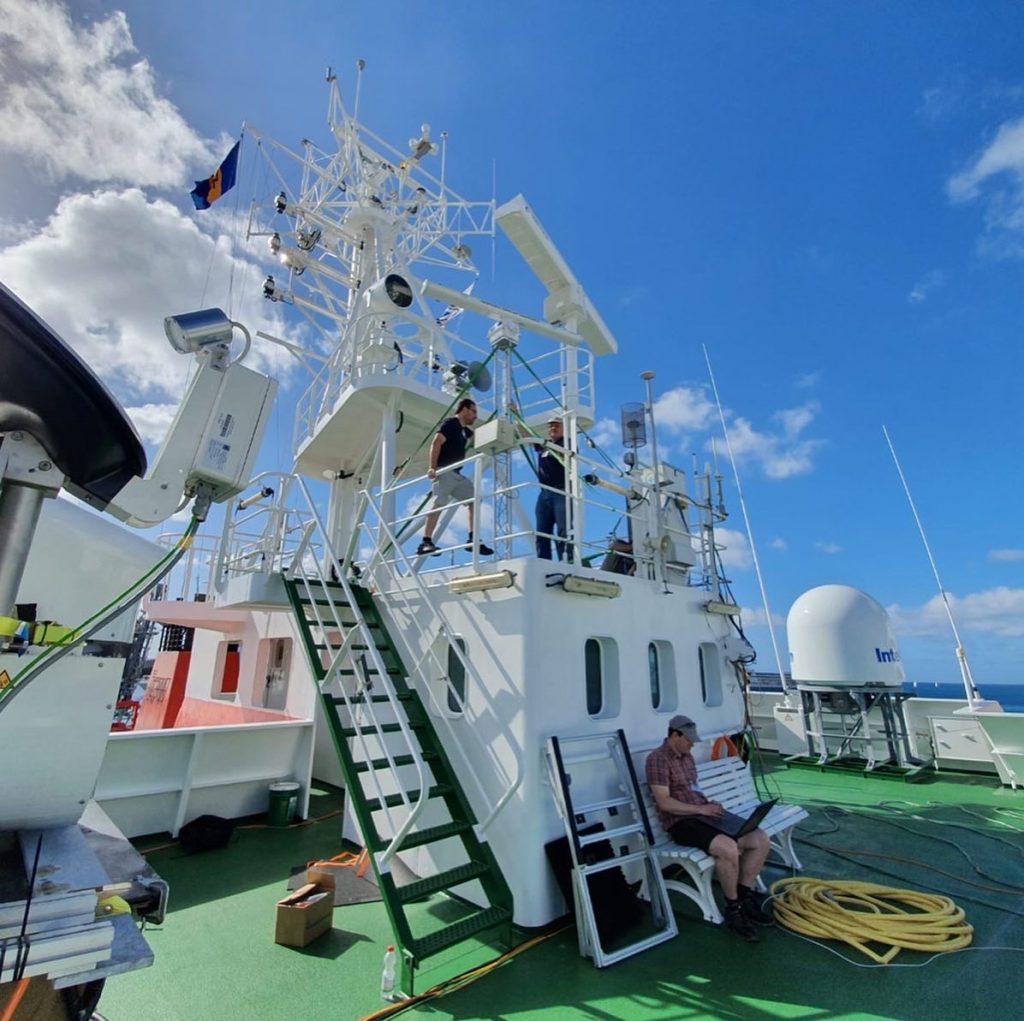
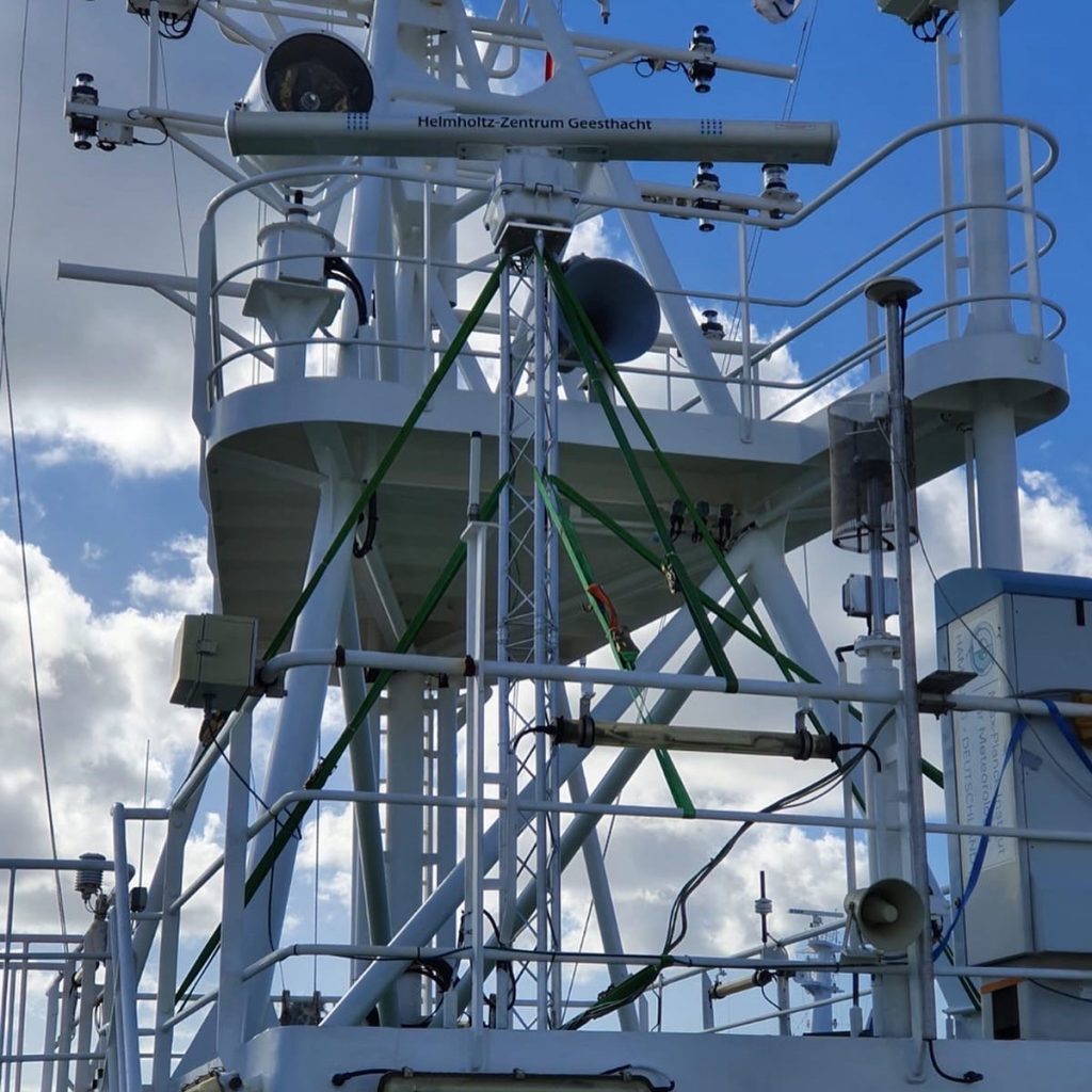
Unser Radar ist ein modifiziertes Navigationsradar (auch marines X-Band-Radar genannt). Herkömmliche nautische Radare zur Navigation messen klassischerweise alles in einem Abstand von ca. 30 Kilometern. Wir aus der Abteilung Radarhydrographie des Helmholtz-Zentrum Geesthacht haben das Gerät so umgebaut, dass es zusätzlich zur Intensität auch die Geschwindigkeit der rückstreuenden Wellen an der Meeresoberfläche messen kann. Die Intensität und Geschwindigkeit der Rückstreuer wird mit einer Auflösung von 7,5 Metern im Umkreis von 3,2 Kilometern um das Schiff herum kontinuierlich gemessen.
Von dem Moment des Ablegens an hat das Radar nun jede Sekunde 870.000 Punkte um das Schiff herum vermessen. Das führt zu insgesamt 280 GB an Radardaten pro Tag, die helfen sollen, die Wechselwirkungen an der Meeresoberfläche besser zu quantifizieren. Dabei geht es in erster Linie um die Parametrisierung des Energie- und den CO2-Austausch zwischen Ozean und Atmosphäre unter Berücksichtigung von Wind, Wellen und insbesondere der Wellenbrechung. Im Rahmen des Projekts EUREC4A-OA werden wir die Daten gemeinsam mit Kolleginnen und Kollegen des GEOMAR und des MPI für Meteorologie auswerten.
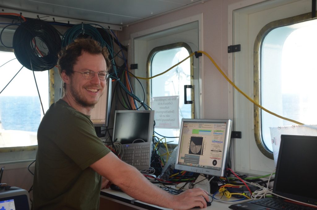
Im Januar waren wir auf Barbados, um das Radar auf dem Forschungsschiff zu installieren. An Bord betreut Klaus Reus vom GEOMAR nun das Radar und sorgt dafür, dass auch alle Daten sicher eingefahren werden.
Jochen Horstmann, Ruben Carrasco-Alvarez (beide Helmholtz-Zentrum Geesthacht, Institut für Küstenforschung) und Klaus Reus (GEOMAR)
Focus on the oceans surface
It rotates and rotates and rotates 24/7 our Doppler radar is operating on the MARIA S. MERIAN and collects data. It measures the roughness of the sea surface, from which parameters such as sea state, currents and wind can be determined.
Our radar is a modified navigational radar (also called marine X-band radar). Conventional nautical radar typically measure everything at a further distance within 40 kilometers. We at the Radar Hydrography Department of the Helmholtz-Zentrum Geesthacht have modified the instrument so that it can measure in addition to the intensity also the speed of the backscatter the waves at the sea surface. The intensity and speed of the backscatter is continuously measured with a resolution of 7.5 meters within a radius of 3.2 kilometers around the ship.
From the moment of departure in Barbados, the radar has been measuring every second 870,000 points around the ship. This results in a total of 280 GB of radar data per day, which will be utilized to better quantify the interactions at the oceans surface. The main objective is to parameterize the energy and CO2 exchange between the ocean and the atmosphere, taking into account wind, waves and, in particular, wave breaking. Within the project EUREC4A-OA we will evaluate the data together in close collaboration with our colleagues from GEOMAR and the MPI for Meteorology.
In January we were on Barbados to install the radar on the research vessel. On board, Klaus Reus from GEOMAR, who now is in charge of the radar and ensures that all data are safely stored and brought back to Germany.
Jochen Horstmann, Ruben Carrasco-Alvarez (both Helmholtz-Zentrum Geesthacht, Institute for Coastal Research) and Klaus Reus (GEOMAR )