By Anne-Sophie Fortin
August 24-26, 2022
If the marine life would have weather forecasts, they would have eddies maps. Eddies are circular currents of tens to hundreds of kilometers in diameter and a lifetime of about a month. They can be seen on satellite imagery as minimums and maximums of sea surface heights and sea surface temperatures.
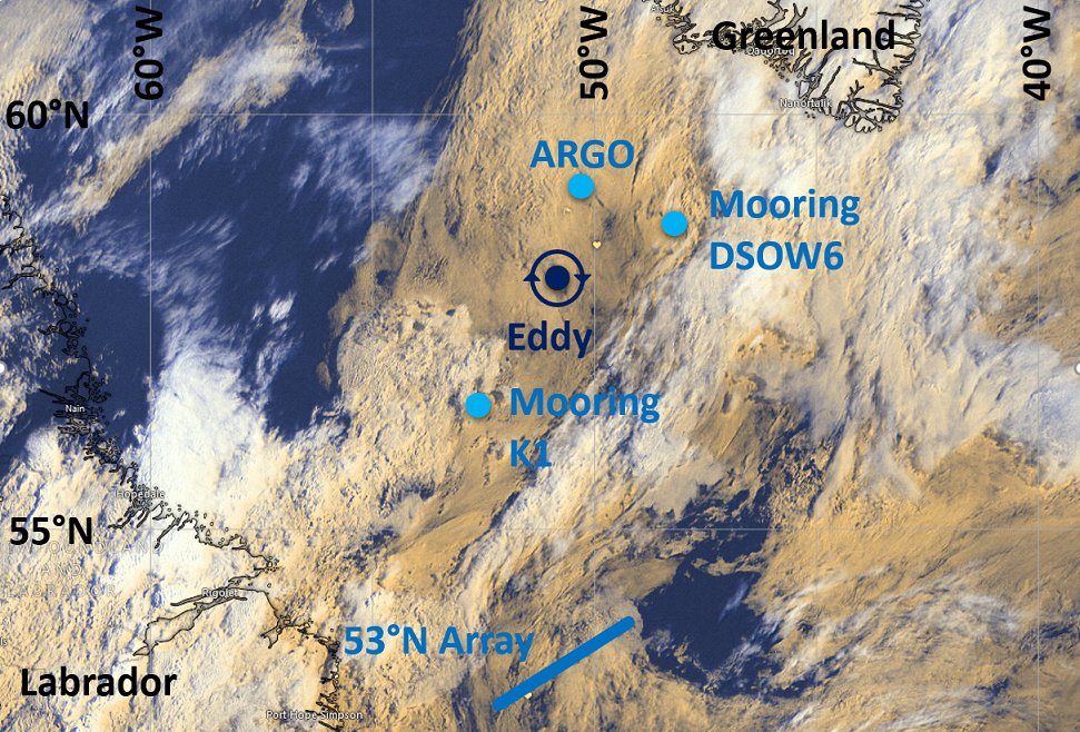
On our way to recover moorings and a defective Argo float, we purposely made our way into one of these eddies, found its center by measuring velocities, and started to deploy instruments (Hereon Drifters, CTD casts, MVP) from the center and along our way out.
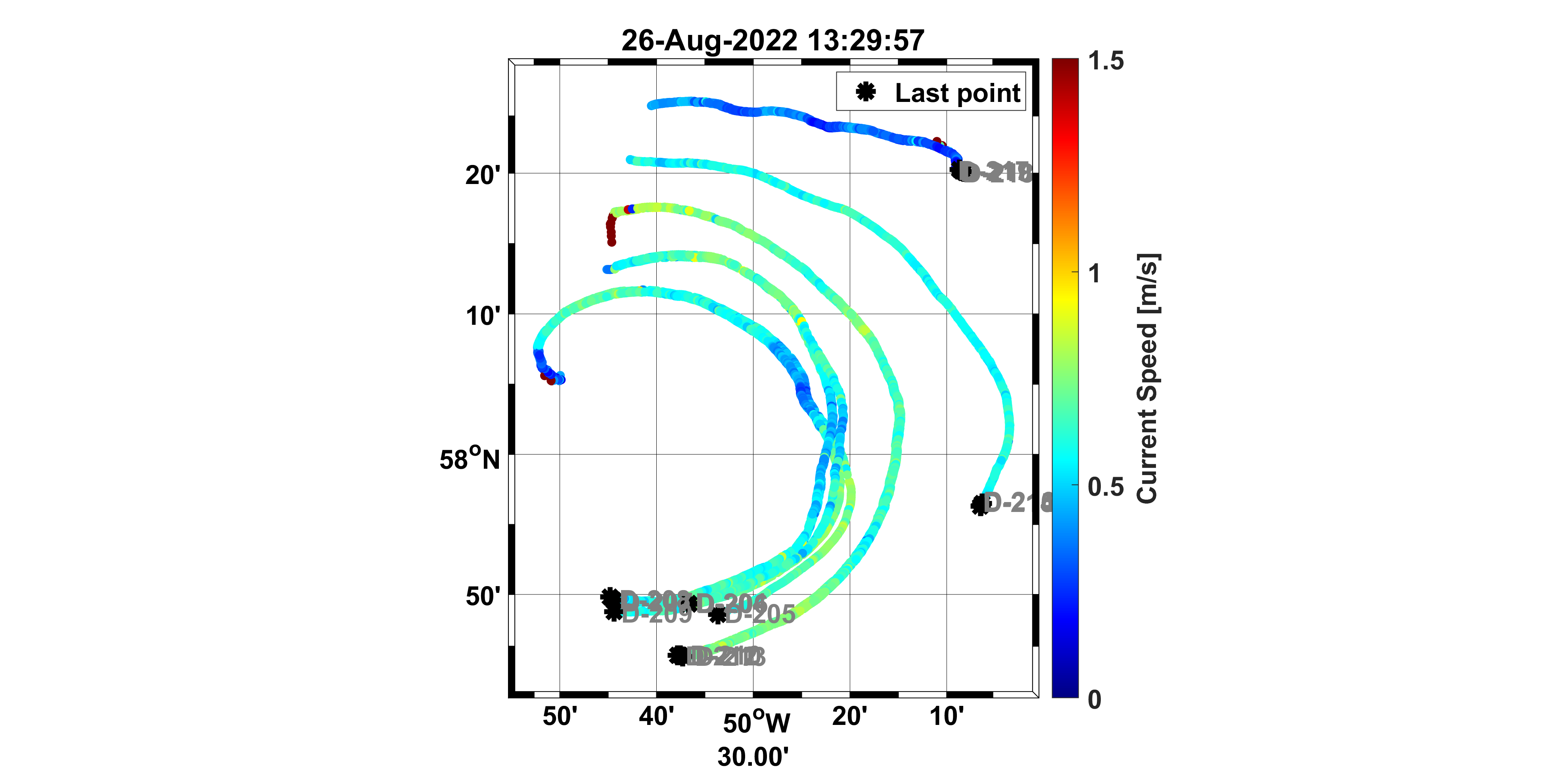
As this eddy is rotation clockwise, we expect that the Hereon Drifters launched along our way out of the eddy will do a couple laps in a clockwise manner for the next couple of weeks. Among the scientific crew, bets are being made on how long it will take for the drifters to make a lap and which drifter will be the first to do so. We have the theory to get an estimate, but real eddies are not perfectly circular as in our textbooks…
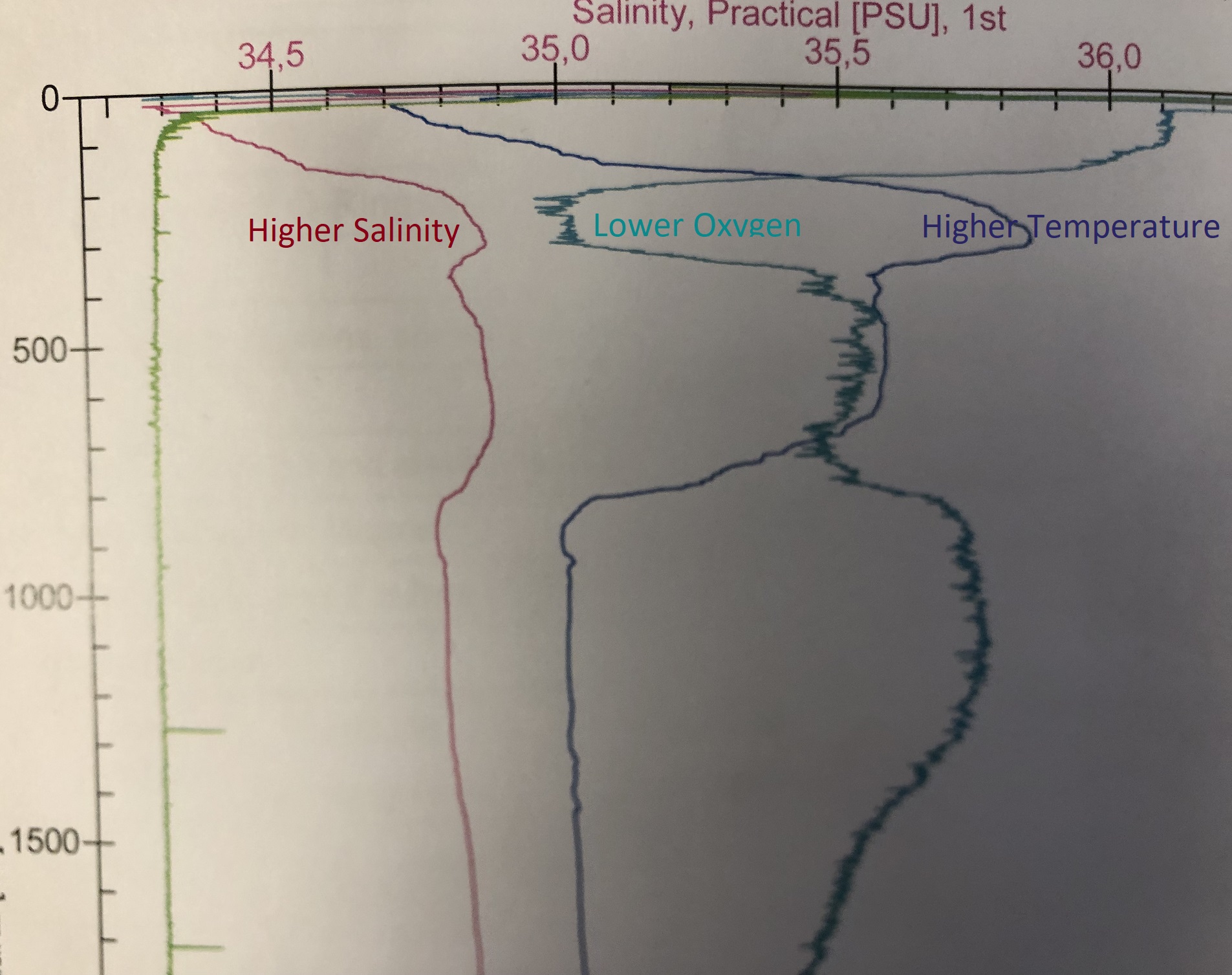
We also expected the eddy to have properties from the Greenland Current, i.e., to be warmer, saltier, and lower dissolved oxygen concentration than the Labrador Sea water mass. That is because we think that the eddy originated in the Greenland Current and moved to the interior of the Labrador Sea without mixing with the water outside the eddy. Our first CTD at the eddy center proved us right. In the eddy core, which extends from about a few tens of meters below the surface to about a thousand meters at depth, we saw well-mixed higher temperature and salinity, and lower dissolved oxygen than the typical values we are used to see in the Labrador Sea.
Koordinaten: 58.3495, -50.712917