By Anne-Sophie Fortin
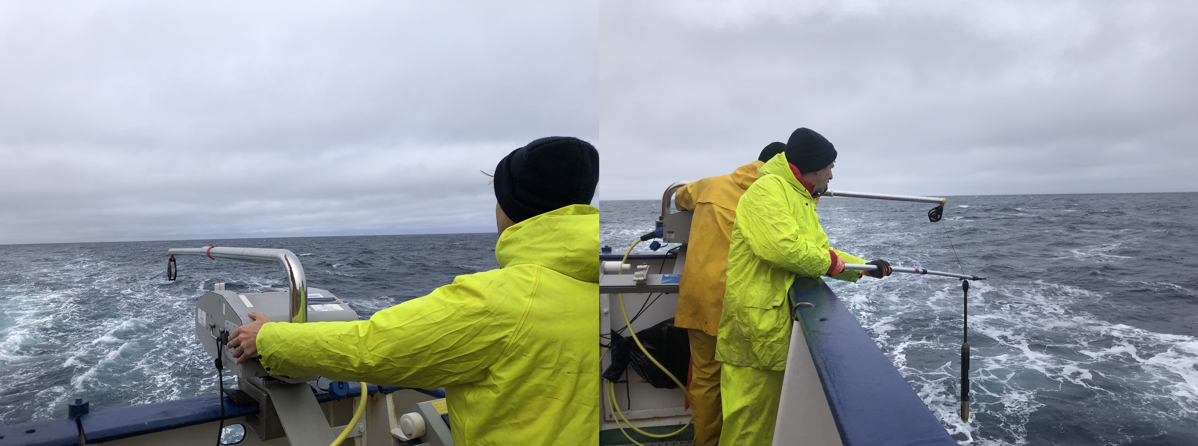
As we transit at full speed (10 knots) in the Labrador Sea, we used the underway CTD (uCTD) to investigate the vertical structure of potential eddies identified from satellite imagery.
The uCTD is a good compromise between research time, efforts, and the dataset we get from it. Indeed, the ability to get measurements while the vessel is moving saves a lot of time. On the other hand, the uCTD measure only the first 450 meters of the water column, while a CTD cast – where the ship must be stationary for about 2 hours – allows us to measure the whole water column, from the surface to the ocean floor (about 3.5 km deep in the central Labrador Sea).
The uCTD takes also more effort to operate than the Moving Vessel Profiler (MVP), which can also be operated while the ship is moving. While the MVP is automatic, the uCTD required someone on the deck to operate the winch and another person to catch the uCTD. The advantage of using uCTD instead of MVP is that uCTD dive deeper than the MVP– about 400 meters for uCTD and 100 meters for MVP – and allow us to better survey eddies structures.
Koordinaten: 55.411052, -48.647032