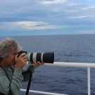
or: ‘What else happens on a mapping ship?’ +++ A guest entry by Michael Force, USFWS Seabird Observer +++ Are there seabirds way out here in the middle of nowhere? Why am I outside all day, in sizzling scorching sun, or in torrential tropical rainstorms, staring at what appears to be a vast empty ocean? While […]
MULTIBEAM MAPPING
or ‘How we map, part I’ Water absorbs electromagnetic waves. That’s why we know so little about the 70 % of Earth’s surface that are covered by water. So mapping the oceans relies on acoustic waves. Echosounder systems emit an acoustic signal and measure the time, untill the reflection of the wave from the seafloor is […]
On a mission to map
As over two thirds of our planet can be considered as unmapped, we have plenty of work ahead of us. The northeast Trade winds bring high waves and make it rough to sail north. But despite cloudy days and heavy rain falls, our incredible chef Debby understands how to lighten the mood. So, we continue […]
Why do we map from a ship?
Today, the sea is calm. We are still on our way south, some wind from behind, and a flat ocean ahead of us. Wait, the sea surface is not flat! The scientists Sandwell and Smith discovered in the early 90’s that the ocean surface isn’t flat at all. Radar measurements from satellites (so-called satellite altimetry) […]
Aloha!
What a nice occasion to start this blog! The Kilo Moana, an US research vessel, will be our home for the next 30 days and will take us to the equatorial Pacific. Research cruises and work at sea are the only way, we can acquire high resolution data from the seafloor. So, I will use this opportunity […]