#MOSESeddyhunt: Neues von der Stemme/News from the Stemme

Das Forschungsflugzeug Stemme der FH Aachen beim Messflug über dem Atlantik. / The research airplane Stemme of the FH Aachen during a measurement flight over the Atlantic Ocean. Photo: Arne Körtzinger/GEOMAR Das Forschungsflugzeug Stemme der FH Aachen beim Messflug über dem Atlantik. / The research airplane Stemme of the FH Aachen during a measurement flight over the Atlantic Ocean. Photo: Arne Körtzinger/GEOMAR

(English below) Hier kommt ein Update von der Stemme-Crew. Diesmal aus unserer neuen “Zentrale” auf Fogo!

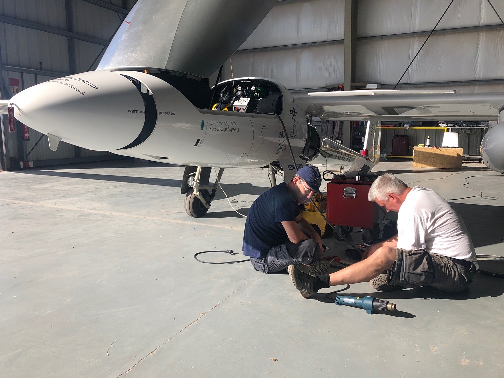
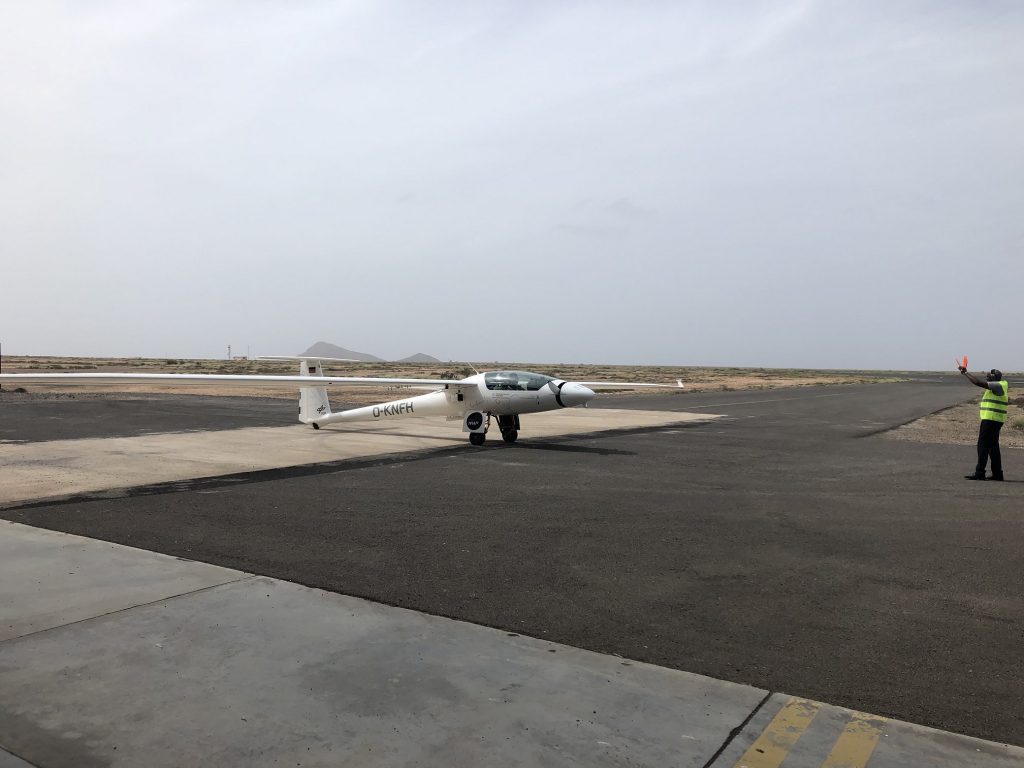
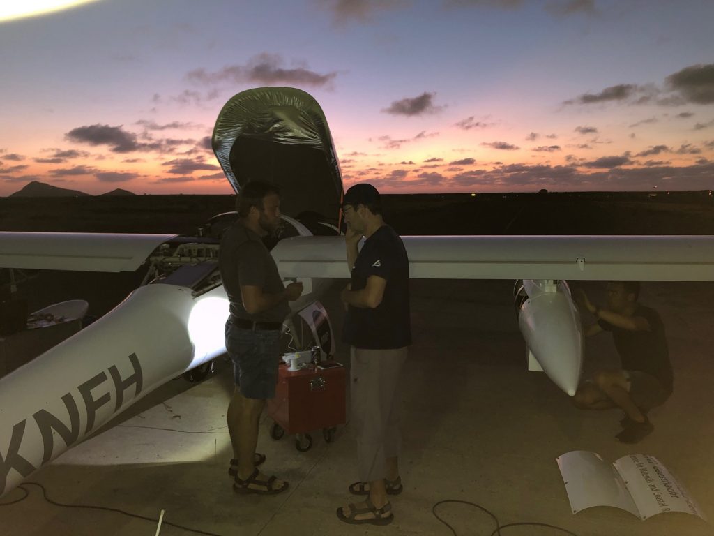
Gestern sind wir mit den wichtigsten Teilen der Ausrüstung von der Insel Sal nach Fogo umgezogen. Da die Fähre wegen der großen Wellen nicht lief, sind wir alle mit dem Flugzeug geflogen. Leider sind einige unserer Geräte nicht angekommen, sodass wir hier ein bisschen improvisieren müssen (neue Kühlflüssigkeit, Treibstoffkanister, Stromkabel etc.). Auch unsere Landstation mussten wir zurücklassen, weshalb momentan keine Datenübertragung in Echtzeit möglich ist.

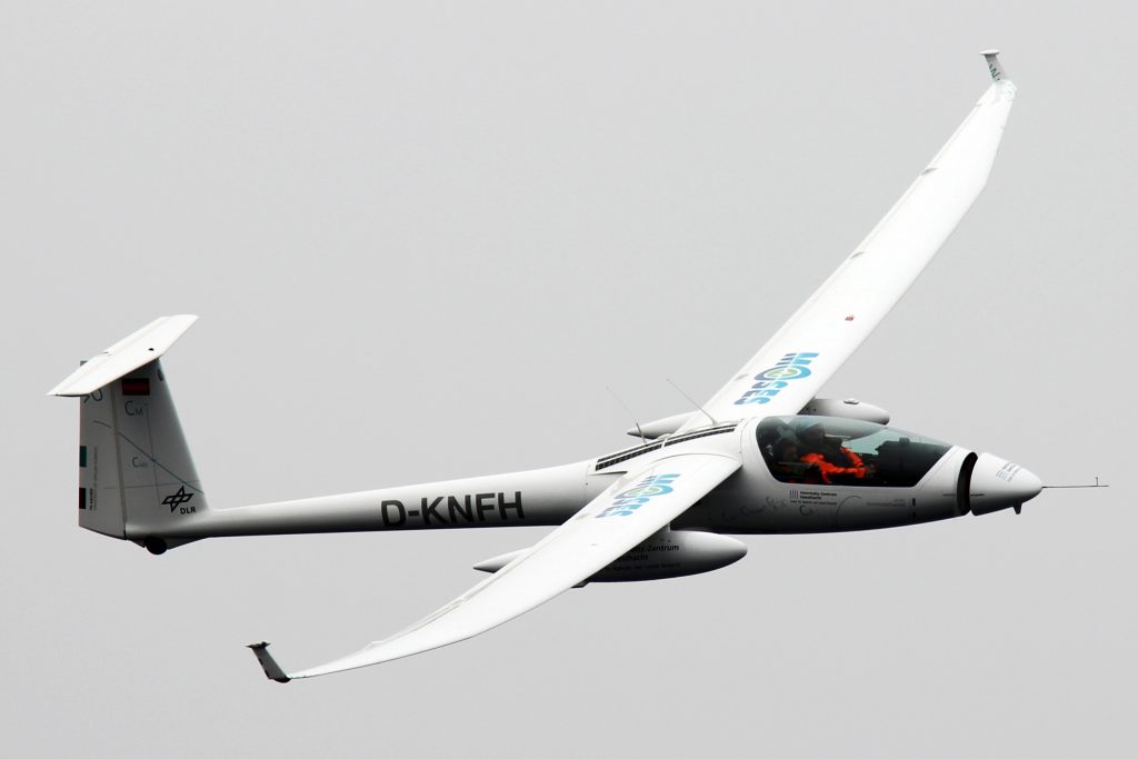
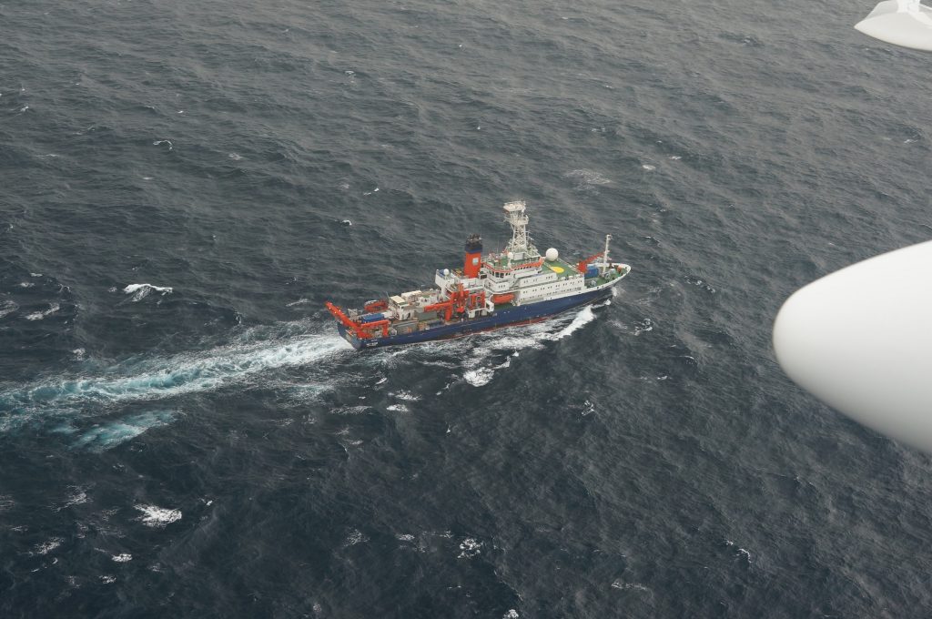
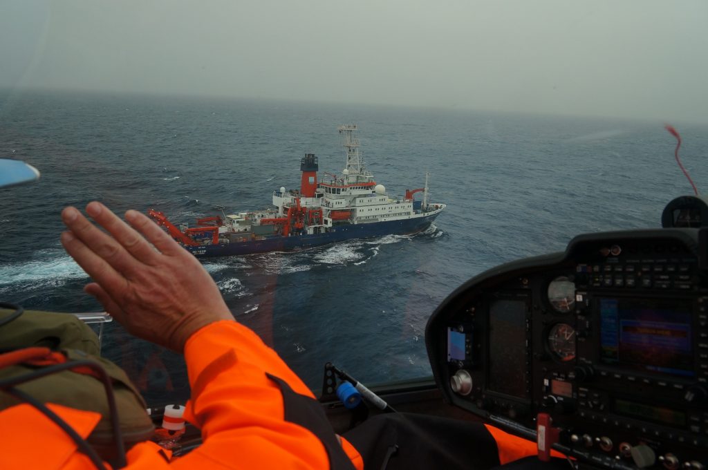
Nichtsdestotrotz konnten wir mit dem Forschungsflugzeug Stemme der Fachhochschule Aachen starten: Nach ein paar Tiefflügen an der METEOR vorbei haben wir etwa zwei Stunden nach dem Fogo-Wirbel gesucht. Dabei haben wir uns auf die Ostflanke des Wirbels konzentriert und einige sehr interessante Strukturen gefunden.

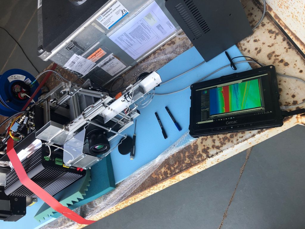
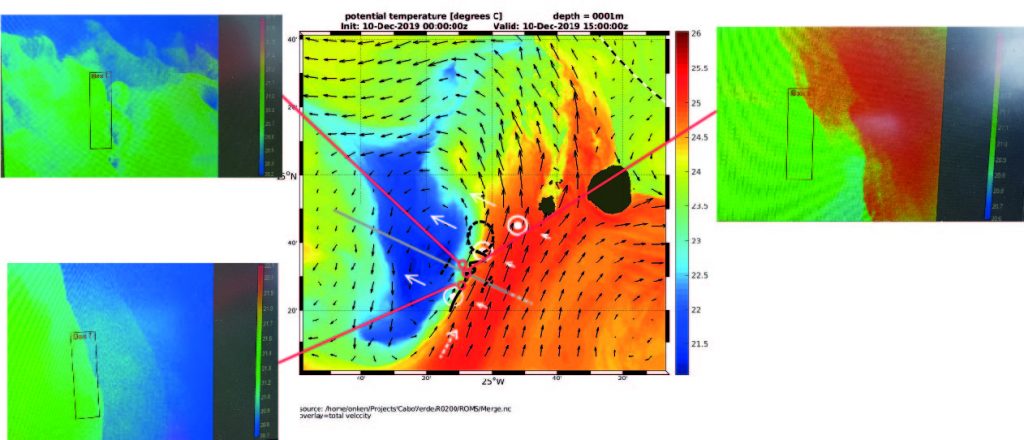
Auf der Karte, die mithilfe des hochauflösenden Computermodells R0200 erstellt wurde, sind die simulierten Temperaturen zu sehen. Die Messungen bestätigen sehr schön die Lage des Wirbels und die allgemeine Frontstruktur. Auf den Screenshots ist eine starke und stabile Front direkt südlich des im Bild skizzierten Transekts zu sehen (kaltes Wasser befindet sich auf der Westseite). Die Vorderseite beginnt sich weiter nördlich zu spalten und zeigt noch weiter nördlich einige wirklich schöne submesoskalige Aktivitäten. Das alles ist innerhalb von ca. 10 Kilometern.

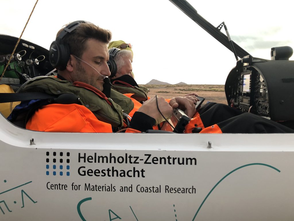
Heute fliegen wir in das gleiche Gebiet, um die Position der Front zu bestätigen und so ein geeignetes Ziel für die Farbstofffreisetzung morgen früh zu identifizieren.

Viele Grüße von der Insel Fogo! Burkard Baschek & Rüdiger Röttgers & Henning Burmester (Institut für Küstenforschung, Helmholtz-Zentrum Geesthacht) und der Stemme Crew

Messtechnik vor. / Rüdiger and Philipp prepare the installation of the measuring technology in the hangar. Photo: HZG/Henning Burmester
Rüdiger und Philipp bereiten im Hangar die Montage der Messtechnik vor. / Rüdiger and Philipp prepare the installation of the measuring technology in the hangar. Photo: HZG/Henning Burmester
Justage der Infrarotkamera vor dem Einbau in den Wingpod. / Adjustment of the infrared camera before installation in the Wingpod. Photo: HZG/Henning Burmester
Kurz vor dem Start zum ersten Messtestflug in über 5.000m Höhe: Philipp und Henning im Cockpit mit Kälteschutzanzug, Rettungsweste, Fallschirm und Sauerstoff-Versorgung. Mit an Bord: die komplette Mess- und Datenübertragungstechnik. / Shortly before the start of the first test flight at more than 5,000m altitude: Philipp and Henning in the cockpit with a suit for cold protection, life jacket, parachute and oxygen supply. On board: the complete measurement and data transmission technology. Photo: HZG/Rüdiger Röttgers
Flight Line Marshaller beim Einweisen der Stemme zum Parking spot am Hangar. / Flight Line Marshaller during the instruction of the Stemme to the parking spot at the hangar. Photo: HZG/Henning Burmester
Von hier oben sieht die FS METEOR fast klein aus - fotografiert aus dem Forschungsflugzeug Stemme. / From up here the FS METEOR looks almost small - photographed from the research aircraft Stemme. Photo: HZG/Burkard Baschek
Von hier oben sieht die FS METEOR fast klein aus – fotografiert aus dem Forschungsflugzeug Stemme. / From up here the FS METEOR looks almost small – photographed from the research aircraft Stemme. Photo: HZG/Burkard Baschek
Beim Tiefflug konnte die Stemme der Besatzung auf der METEOR zuwinken. / During the low-altitude flight the Stemme could wave to the crew on the METEOR. Photo: HZG/Burkard Baschek
In der Mitte sind die simulierten Temperaturen zu sehen - in den Screenshots links und rechts zeigt sich, dass die gemessenen Daten sehr gut damit übereinstimmen. / In the middle you can see the simulated temperatures - in the screenshots on the left and right the measured data match very well. Photo: HZG/Burkard Baschek
In der Mitte sind die simulierten Temperaturen zu sehen – in den Screenshots links und rechts zeigt sich, dass die gemessenen Daten sehr gut damit übereinstimmen. / In the middle you can see the simulated temperatures – in the screenshots on the left and right the measured data match very well. Photo: HZG/Burkard Baschek
Nach der Landung: Absprachen zwischen Wissenschaftler und Pilot für den nächsten Messtag. Am Flugzeug ist ein externes Spannungsversorgungsgerät für die Messtechnik angeschlossen. Rechts im Bild ist der geöffnete Messtechnik-Wingpod zu sehen, der unter anderem die IR-Kamera, Hyperspektralkamera, Datenverarbeitung und Lagesensorik enthält. Dort werden auch die der Festplatten zur Sicherung der Messdaten entnommen. / After landing: Discussions between scientist and pilot for the next measurement day. An external power supply unit for the measurement equipment is connected to the aircraft. On the right in the picture you can see the open measuring technology wing pod, which contains the IR camera, hyperspectral camera, data processing and position sensors. The data from the hard disks are also taken there to back up the measurement data. Photo: HZG/Henning Burmester

Here comes an update from the Stemme crew. This time from our new “headquarters” on Fogo!

Yesterday we moved with the most important parts of the equipment from the island Sal to Fogo. Since the ferry didn’t run because of the big waves, we all flew by plane. Unfortunately some of our equipment did not arrive, so we had to improvise a bit (getting new cooling liquid, fuel canisters, power cable etc). We also had to leave our land station behind, which is why data transmission in real time is not possible at the moment.

Nevertheless we could start with the Stemme, the research airplane of FH Aachen: After a few low-level flights past the METEOR, we searched for the Fogo eddy for about two hours. We concentrated on the east flank of the eddy and found some very interesting structures.

The simulated temperatures can be seen on the map, which was created using the high-resolution computer model R0200. The measurements confirm very nicely the position of the eddy and the general frontal structure. The screenshots show a strong and stable front directly south of the transect sketched in the picture (cold water is on the west side). The front starts to split further north and shows some really nice submesoscale activities even further north. This is all within about 10 kilometres.

Today we fly into the same area to confirm the position of the front and thus identify a suitable target for the dye release tomorrow morning.

All the best from the Island Fogo! Burkard Baschek & Rüdiger Röttgers &Henning Burmester (Institute of Coastal Research, HZG) and the  Stemme crew