Happy New Year! We celebrated New Year’s Eve on board the FS METEOR with a relaxed evening, toasting the New Year together at midnight. We have had a good start with the new year and will continue with our measurements on the FS METEOR right away. A new year of research begins with a dive by the video sled MOMO, which we regularly send on underwater exploration trips during the cruise. In the following posts, we will introduce some of our measuring instruments and their teams to give you an idea of what a typical day on a research vessel involves.
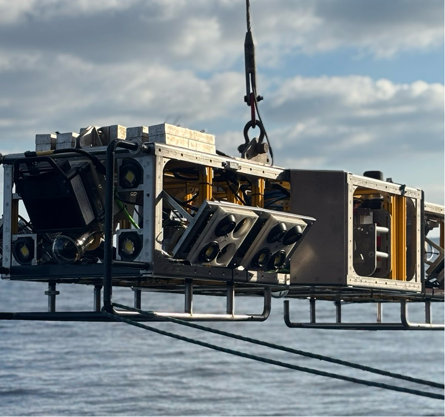
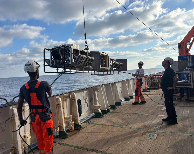
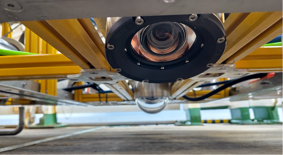
MOMO, short for Modular Mobility Seafloor Observation and Sampling System, is the name of the underwater video sled that accompanies us on the M215 (MMC – 3). The sophisticated measuring system, which was developed last year by the team on board at GEOMAR, is lowered into the water for its dives using a winch and travels about three metres above the seabed ‘along with the ship’. The multi-talented device collects all kinds of high-resolution data: two side-mounted, downward-facing cameras continuously take photos as MOMO glides through the water just above the seabed. By overlapping the images, a detailed map of the seabed with an accuracy of up to 4 mm can be created using photogrammetry. In addition, 3D hydroacoustic sensors are used, which provide three-dimensional information about the seabed and are particularly helpful for MOMO’s navigation. The RV METEOR has to work hard to achieve this: the profiles, which are 4 metres apart, must be approached and maintained as accurately as possible, which is a challenge as the ship generally maintains its course with an accuracy of about 2 metres. Of course, this is a virtually insignificant deviation on the high seas, but it does pose difficulties for microbathymetric measurements with MOMO, especially as we are often caught by strong downdrafts in the caldera, which push the ship to one side. The officers on the bridge and the MOMO scientific team therefore communicate continuously with each other during the four- to twelve-hour dives to ensure that MOMO travels along the most exciting routes.
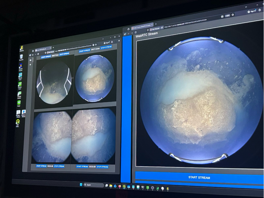
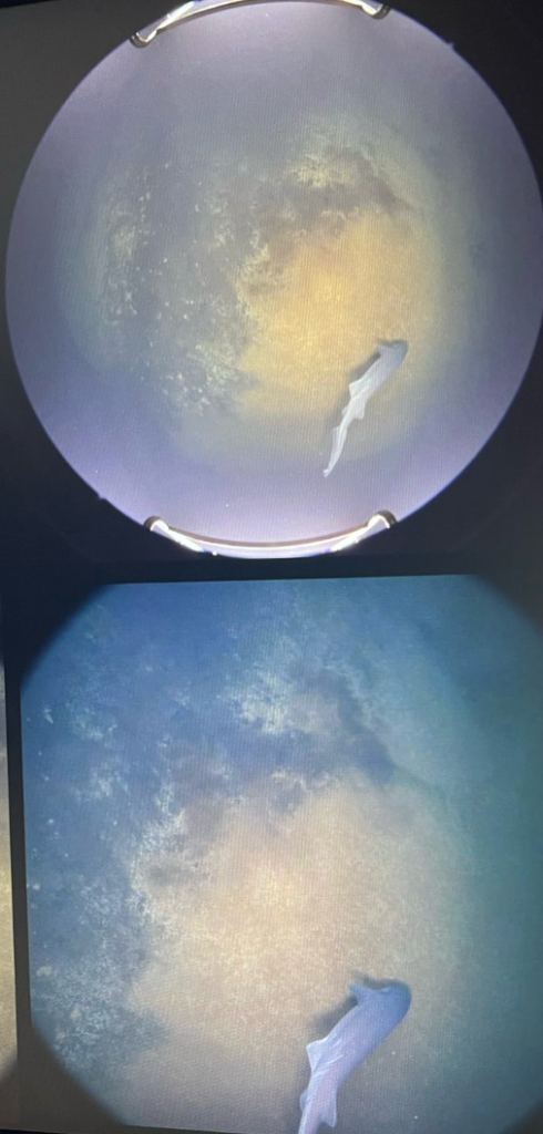
There is no shortage of exciting places to explore! Of particular interest are the structures discovered during the first MULTI-MAREX expedition, MSM132 (MMC – 1), at the end of last year in the Santorini caldera: the so-called Kallisti Pools. This is a complex relief structure of bacterial mats on the seabed that are associated with extensive gas emissions (mainly CO2 and methane). These gases collect at the bottom of the ‘pools’ as a milky white substance. Little is known about them yet, and we are particularly interested in its variability over time and in the context of the earthquake swarm at the beginning of this year. Research by British colleagues indicates rapid change – making it all the more important to compare last year’s maps with our current measurements. A special highlight during the measurements is the screen transmission to the RV METEOR’s geo-lab, where everyone watches with fascination as MOMO’s camera captures the action live.
This prompts everyone on board to ponder how the structure of the Kallisti pools can be explained. Our colleague Everardo Gonzáles presents a mathematical approach that would describe the shape of the pools exactly: By varying two parameters of the Gray-Scott model, the same structures that we find on the sea floor are produced. After the presentation, there is a lively discussion, theories are put forward and then rejected or modified, and Greek, German and international colleagues exchange contact details. One thing is certain: sooner or later, the mystery of the Kallisti Pools will be solved!
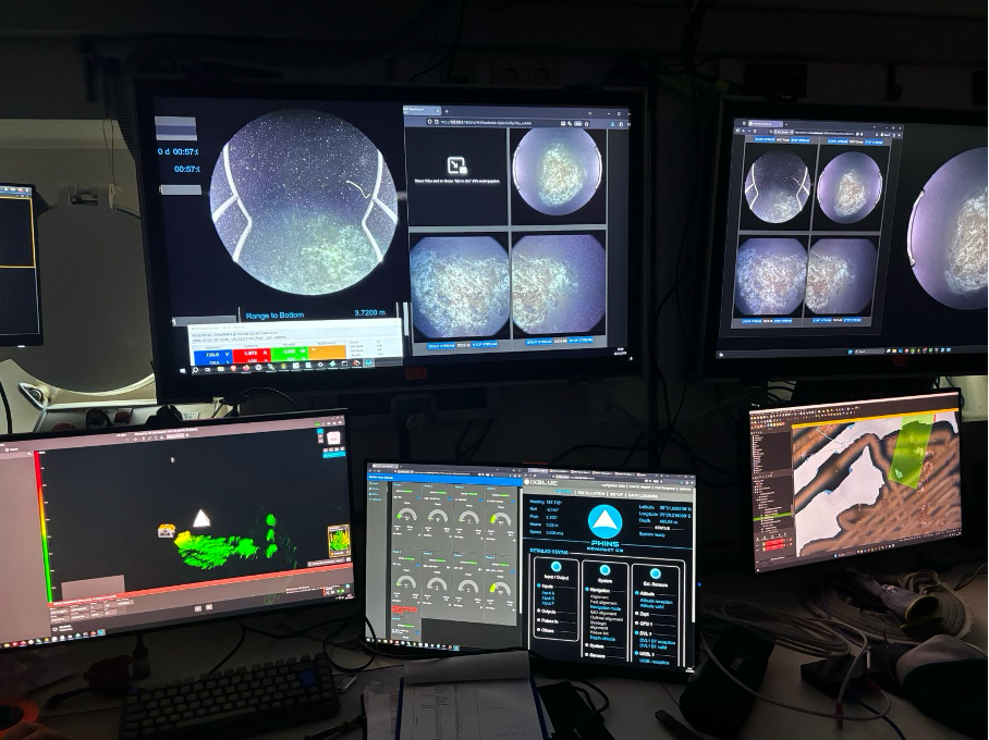
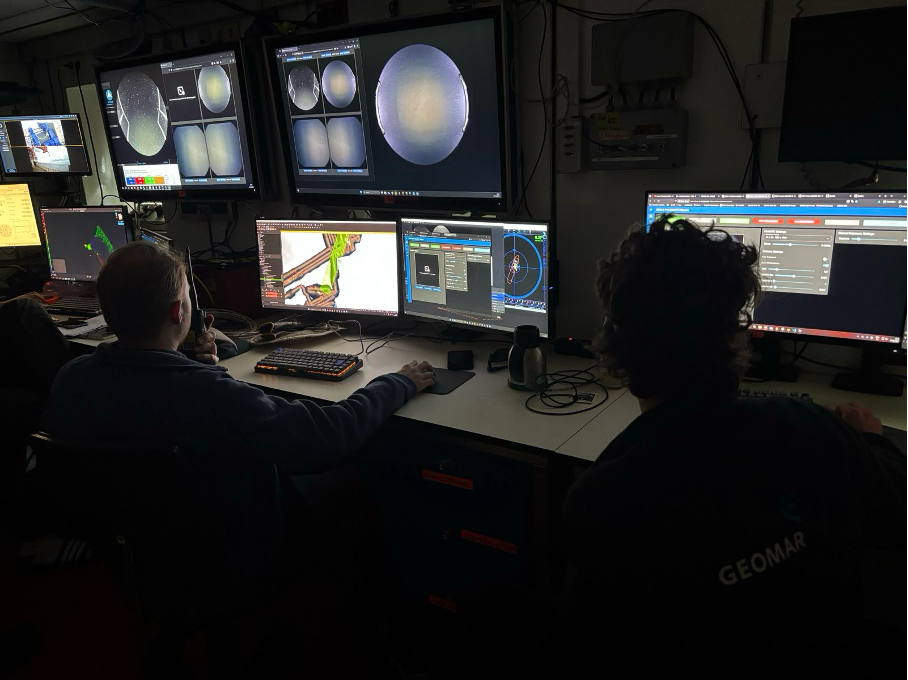
When taking measurements with MOMO, quality takes precedence over quantity. The end result is high-resolution, detailed maps of the seabed in selected areas, which were chosen based on bathymetric measurements taken by the AUVs and ship-based mapping systems. After a long dive with excellent teamwork, pin-sharp images and the utmost concentration in controlling the winch, our four-person MOMO team can sleep soundly. Until the next dive, but now it’s time for other measuring instruments to take over – more on that in the next post!
The M215 (MMC-3) team