As a computer scientist I am used to working with different types of data collected from various sources. Recently, I started my PhD in the MarData program that aims at bringing together – amongst others – computer science and oceanography. “That’s cool!”, I thought, “just another kind of data to do analyses on!”. But the data collection process for oceanographer’s work is different from everything I have known so far.
The data that an oceanographer is interested in are – naturally – from the ocean. Nowadays, obtaining data from the upper layer of the ocean is not a huge problem. There are satellites that measure things like sea surface temperature and sea level anomalies 24/7. But what about the deeper ocean? What about the data oceanographers need to understand how the ocean currents transport the water around the globe? How is this data obtained?
Quite different from the experience I had with other data – such as social media interactions – there is no direct download link from a coordinate and depth in the ocean somewhere on the globe. So, to get the data, first of all, you need to get on a ship and travel to the area of interest. This is, what I was invited to: On this cruise we sample some part of the tropical South Atlantic ocean and I am starting to get a feeling for how the data (remember: I thought “just another kind of data”) is collected.
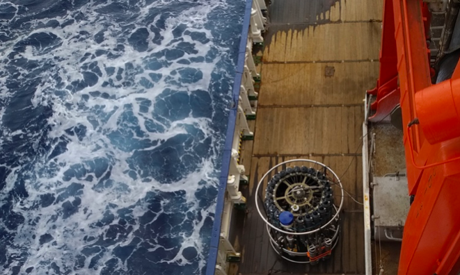
Once being in the correct coordinate location, a measuring device called CTD is lowered from the ship to the ocean floor. It measures different parameters of the water – such as pressure, salinity and temperature – on the way up and down. The data obtained with the CTD needs to be calibrated and cleaned, so that the measurements are accurate enough to be used for analyses and models. For calibration water is sampled on the way up and afterwards chemically analysed to compare (and calibrate) the CTD’s measurements with these values. All in all, sampling down to 4000 or 5000 m takes about 3 hours – and we are doing many samplings on this trip.
One of the most surprising things that I had not thought about in front of my laptop until I took my first water samples: near the equator, the surface sea water is about 28°C warm, but the water sampled from the deep is freezing cold! So taking the water samples is quite refreshing…
In the end of this journey, we will have collected a huge amount of data in this way, but we will only have covered a really small part of the ocean. I will remember this cruise the next time I fail to find data for a certain part of the ocean because now I know how much work obtaining these data points is.
Written by Carola Trahms, GEOMAR 2019